CGAP: A Hybrid Contrastive and Graph-based Active Learning Pipeline to Detect Water and Sediment in Multispectral Images
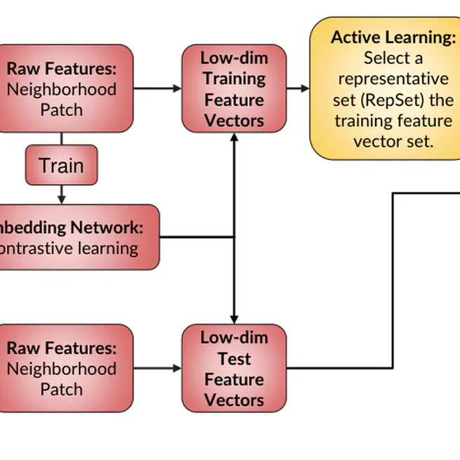
The contrastive graph-based active learning pipeline (CGAP) combines a learned feature embedding with graph Laplace learning to classify land, surface water, and near-water sediment in Landsat imagery. Custom contrastive augmentations make the features robust to geometric transformations, changes in spatial resolution, and light cloud cover while reducing the dimension used for graph construction.
Jun 7, 2024
Graph-Based Active Learning for Surface Water and Sediment Detection in Multispectral Images
The graph active learning pipeline (GAP) treats multispectral pixels as nodes in a similarity graph and uses graph Laplace learning to distinguish land, surface water, and in-river sediment. An acquisition function identifies the pixels whose expert labels are expected to improve the classifier most, directly targeting the expensive step of building a hand-labeled remote-sensing dataset.
Jul 1, 2023